<firstimage="https://www.makeuseof.com/wp-content/uploads/2011/01/wundergroundmap-icon.png">
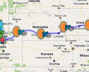
Get your directions, with information about the weather on your route. That's Wunderground's excellent Road Trip tool, which shows the temperature of the places you're going at the times you're going to be there, as well as any extreme weather you might want to be aware of. You can even print it all out!
If you're about to take a road trip, you're probably about to fire up Google Maps. That makes sense; the service is just about the best there is when it comes to quickly finding directions, no small part of the reason it's the default map program on the iPhone.
But good as Google Maps is, it doesn't do everything. Or, at least, it doesn't do everything on its own. There are numerous awesome and useful Google Maps mashups out there that do just about anything you can imagine. So it should come as no surprise that the best weather site on the web offers a Maps mashup of it's own. This is particularly useful in the winter months, when heavy snowfall can make driving dangerous or impede progress.
There's only one catch: the application is currently US-only, which made it slightly less useful during my recent drive from Colorado to Ontario. Still, the idea is solid enough that it's worth knowing about if you ever think you'll be in the States.
Getting Started
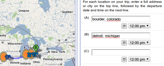
Head over to the Wunderground's roadtrip page [Broken URL Removed] to get started. You can enter the various co-ordinates in your trip, as well as the time and date you intend to leave.
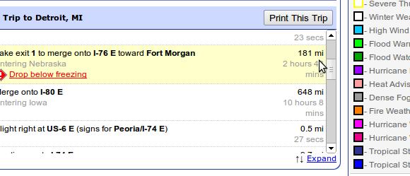
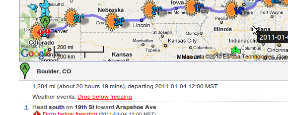
Once you've entered your co-ordinates and times, you'll see a map outlining your route. This isn't that different from your standard Google Map, and even includes the standard turn-by-turn directions. The main difference is that the map also includes weather, showing the temperature and conditions along your route.
Other Features
There's more to this, though. Checkboxes below the input dialogue allow you to display severe weather on your map, and even to highlight areas of heavy traffic. While the traffic is obviously a lot harder to predict than the weather, it's a great tool to check how conditions are right now.
The severe weather display, on the other hand, is extremely useful if you plan on taking a long trip. Snow storms in Minnesota, for example, probably mean that stopping outside that state rather than driving all night is a good idea.
You can also print your entire route, in a manner similar to Google Maps but with road trip weather information. Nice.
Similar Services
There are other services like this out there, of course. The Weather Channel offers the interstate forecast, which focuses on America's main routes. WeatherBonk also offers a route weather tool, though I personally find it a great deal less useful than Wunderground's offering. I've yet to find a tool like this that works outside of the United States, but am very open to suggestions.
Please let me know about any and all similar services in the comments below, because sharing is awesome and so are you.


