When traveling, or otherwise on the move, you might want to get your exact location. Not just where you are right now, or where you're going, but also where you've been.
For practicing sports, this can prove quite difficult. Have you ever tried mounting a dynamo to a pair of skis? Take it from me; it does not work.
The next step takes us to radar and outdoors GPS technology. And either of those will cost you an arm and a leg.
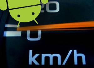
But there's another alternative. If you've got an Android phone with GPS, there are a ton of free applications that'll let you get the location of your Android and exactly how fast you were going. Best of all? Using a GPS doesn't cost a dime, so you can use it to suck your battery dry anywhere in the world!
GPSTracker Lite
There are a ton of free GPS tracking applications, but merely a handful of them are actually worth anything. More than one gave false readings, sometimes with speeds succeeding 460 kilometers per hour (approximately 285 miles/h). Flattering, but not realistic for skiing. On the other hand, GPSTracker came forth as the obvious champion.
GPSTracker keeps track of pretty much everything a GPS can supply. This includes speed, altitude and location. You can view the recordings as raw numerical data, graphs, or as a Google Maps overlay.
After launching the application, you can create a new GPS log by specifying the filename, description, and even the kind of sport or transport you'll be using. While tracking, you can add a checkpoint with a flick of the thumb. These will start a new travel chapter, and show on the various graphs and the map overlay.
Accessing GPS Tracking Data
As previously said, there are a number of ways to visualize the tracking data on your Android. A rather extensive overview can be reached via the State button. This will show you most data that's instantly available, including the exact GPS coordinates, altitude, speed, GPS accuracy, traveled distance and - with a turn-by-turn GPS - orientation.
Of course, when exported, you've got a lot more data at your fingertips, with near to a thousand of these GPS points saved every hour. Said GPS logs can be easily exported from the main screen.
A little more accessible are the speed and altitude graphs, very similar in implementation. Here you can view the approximated speed on a time axis, including minimum, maximum and average. The checkpoints are viewable on the graph as yellow dots, and you can add more of them on the spot.
But either of those fade in comparison to the map view. Here the GPS data is added to Google Maps as an overlay. The data can be visualized in a number of ways. Perhaps, most interesting are the altitude and checkpoint notation. The latter one with differently colored segments between checkpoints. Please note that although GPS use doesn't cost you anything, using mobile internet does! Don't overdo on the maps if you're on a bad data-plan, or abroad.
Have you ever used GPS applications on your mobile phone? Let us know in the comments section below!