Google has probably done less for the mass effect of photography than Facebook (the acquisition of Instagram tipped the balance), but the contribution has been nothing short of the word “generous”. You can connect with the top photographers on Google+, and use Picasa to organize all your and geotag your photos. Google also has the interfaces that allow the really creative among us to experiment with things like hyperlapse photography and create stunning visuals. In a nice little update, Google also introduced Views, a fledgling but hoping to be big community of panoramic image enthusiasts.
Singing ditties for Google though is taking us away from the one of its most useful products and how we can use it for our photography learning. Google Maps has been a staple in our phones and on our computers, but are we really using it to give our photography some help with the groundwork? Let’s put Google Maps to some obvious and some not-so-obvious uses when we are lugging around our camera.
Scouting for Locations to Shoot
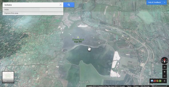
Wouldn't it be great if you could do your photography homework even before you reach a spot? Scouting for locations to shoot photos sounds like a no-brainer, but it is actually a more painstaking process. Google Maps coupled with Google Earth could be your scouting tools for narrowing down on the right location to take a photo from. One of the ways is to spot “green” areas with the satellite view on Google Earth or Google Maps. These could be offbeat green habitats away from the hustle and bustle of urban crowds. For instance, the above screen grab shows a patch of wetlands near my city. Of course, make sure there are usable routes to get there, at least on foot.
Using Google Maps for location scouting has a few more basic uses:
- You can use Google Maps to find the shortest or the easiest route to get to an inaccessible spot.
- Even if a location is familiar, the map tools can help you explore surrounding areas which you might miss otherwise.
Save Addresses For Later
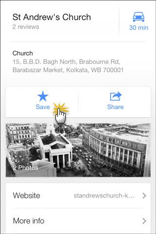
Using Google Maps as an index for all possible photo-shooting spots has is a time saver – you can save all addresses along with map directions and choose from them when you actually set about to go there. Build up a collection of places when you are out and about in the town, and refer back to them later. The Maps app on your phone or tablet is perfectly suited for entering GPS information to precisely pinpoint the locations. This also makes it easier to share the routes with others who might be going with you.
Plan a Photo Walk
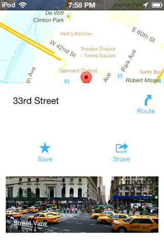
The new maps on your mobile make it even easier to plan a photo walk. With GPS enabled, you can select the locations you want to cover. Select the spots with your finger and drop a pin. A transportation icon is displayed on the bottom right corner of your screen. Tap on it activates turn-by-turn GPS navigation.
The Android version for Google Maps also supports offline maps which helps you navigate the old-fashioned way. Before leaving home, you can connect and click on Make this map area available offline.
Street View Imagery
Street View Imagery is a vast collection of photos already available to you to choose and pick from for your photo inspirations. You can see the precise spot right there, and then use the existing Street View image to plan your own photo a bit differently. On the Android and iOS apps (and also the desktop), you can now simply click and drop a pin on any spot and explore the street view imagery that’s available. For instance, you can combine Google Search and Google Maps to search heritage sites or hunt rundown buildings and use them as backdrops. Checking the area out before on Street View could help tell you if it’s suitable for your shoot.
Street View itself has been a source of photographic inspiration for many projects. Jon Rafman’s 9 Eyes Project is a collection of images he collected from Google Street View with searches and from other different sources. The photos have turned into an interesting book which shows the nature of life around us – sometimes weird, sometimes common.
Use Google Maps (and an app) to See the Effect of Natural Light
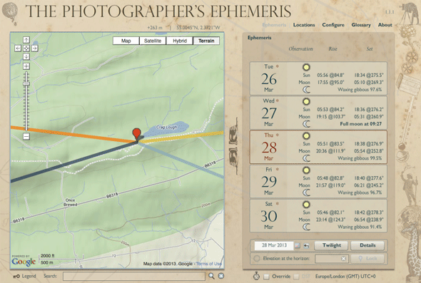
Photography is about light. If you do a lot of your photography around natural light, then knowing where and when to shoot could save you the cost of a wasted trip. There are applications that can help to take out the guesswork and one of the better tools is built around Google Maps. The Photographer’s Ephemeris is a light estimator that tells you how light (daylight or moonlight) will cast on the area you are planning to shoot at. Outdoor photography is where the action is, and the TPE calculator can help you pitch your camera at the precise vantage spots and at the exact time to get the right perspective.
Unlike a lot of other calculators, it takes terrain into account. The benefits of having this highly-recommended app in your pocket are more than one -- You can effectively catch the Golden Hour at any location on Earth. You can also use TPE for urban settings as the interplay of shadows and reflections is a creative photography. I haven't tried it myself yet, but looking forward to.
TPE has a range of features which help you plan and manage your locations. The device specific tutorials on the site lead you through them. TPE is available for iOS ($8.99), Android ($4.99), Windows and Mac (free, requires Adobe Air).
Geotagging photos with the help of Picasa and Google Earth is an old tip which I didn’t bother repeating here, but if this is the first time you are hearing about it, Google’s support page walks you through the easy process. Photography is about being at the right spot and then turning the ordinariness of that place to something remarkable. Do you use Google Maps as a photography aid? Do you have any tips that could help to make our photos a little better or the process more efficient? Shoot them in the comments.

