Google Earth is a program and online tool to view the Earth in 3D. You can spin the globe and visit anywhere you want, right from the comfort of your home.
Not only can you view the Earth from above, but you can also roam its streets too. You might be wondering how Google Earth collects all these images.
We're going to tell you how Google Earth gets its images and how often Google Earth is updated.
What Is Google Earth?

Google Earth lets you view a 3D representation of the Earth. You can freely spin the globe and zoom in to explore places. Alternatively, you can input a location name, address, or coordinates.
It's different from Google Maps. "Google Maps is about finding your way. Google Earth is about getting lost," says Gopal Shah, Google Earth's product manager. You can even go on a virtual tour of the world with Google Earth.
Google Earth combines all of Google's powerful mapping tools. You can see place names, road markings, weather data, and more, all from within the tool. Not only can you view flat satellite imagery, but you can also tilt the camera to get a 3D perspective. This isn't available everywhere, but it's a fantastic experience for major cities and landscapes.
Google Earth is available for browsers and for desktop. The desktop version offers more features (known as Google Earth Pro), so that's the one to use if you want to get the most from Google Earth.
The History of Google Earth
Intrinsic Graphics developed Google Earth's technology before the turn of the millennium. The company focussed on 3D gaming software libraries and it developed a demo of the spinning globe that you could zoom in to.
Intrinsic Graphics span out into another company called Keyhole, which sold mapping software to companies in industries like urban planning and defense. The company was struggling until it struck a deal with CNN. Keyhole's logo was prominently displayed during the analysis of the 2003 invasion of Iraq, which gave them a needed publicity boost.
A year later, more than 25% of Google searches were related to maps or directions, and so Google bought Keyhole and went on to create Google Earth.
How Are Google Earth Images Collected?
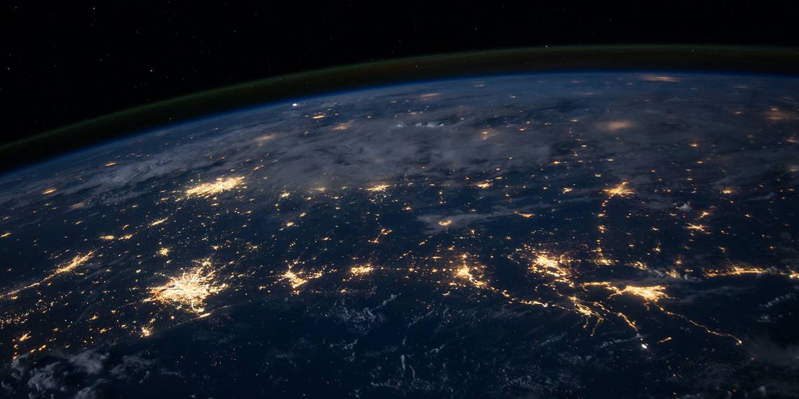
Google Earth collects images through a variety of methods like satellite, aerial, and Street View photography.
Satellites give the 2D global view of the Earth. These images are collected through lots of different third parties. As you view Google Earth, look at the bottom of the screen and you'll see the copyright data. This tells you which company (or companies) provided those images.
For 3D photography, Google flies special aircraft that have lots of mounted cameras that can capture the necessary data and detail. This is only possible in areas where local and federal regulations permit it.
The Street View photography is what you might be familiar with from Google Maps. This is collected by cars mounted with cameras that literally drive around and capture the images.
How Often Is Google Earth Updated?
Google Earth doesn't provide live imagery, so you can't zoom in to your current location and wave at the camera. Instead, it creates a whole image of the Earth by piecing together millions of static images.
Google collects some of its images from third parties, so the rate at which it can update parts of Google Earth is reliant on others.
There's no schedule for how often Google Earth updates its images and there are various factors to take into account. Here are the main ones.
1. Location
Areas of interest or high density are more likely to be updated than rural villages. This is because these areas are prone to greater change, but also because these areas are the most frequently searched and viewed by users.
For example, New York will update regularly with high detail images because Google can fly its aircraft to collect imagery and there will be many third-party companies to provide satellite imagery.
2. Security
Some locations are rarely or never updated due to security reasons. The images of these places may be old, blurry, or entirely blacked out. This is typically due to requests from governments or personal lawsuits.
Google might also stop updating a certain area if they discover that the imagery is being used for military intelligence or crime. The same goes for no-fly zones and conflict areas.
3. Time and Money
Time and money are scarce resources. When you zoom in on Google Earth, to the point where you can see your car clearly parked on your driveway, then that's the work of aerial photography. However, if your house is a barely discernible brown blob amidst a landscape of psychedelic blurs, then that's the work of a satellite suspended above the equator.
Obviously, it takes time for these aircraft to run those photography update missions. They are also run by a number of private companies, not by Google itself, so getting all these images pieced together takes even more time.
Not only does it take time, but it also costs money to collect these images, compile them, edit them, and upload them.
4. Weather
There's no point snapping photos of a place that is constantly covered by clouds. There'd be nothing to see! As such, it can sometimes take time for Google to get clear shots that aren't impeded by the weather.
An example of this is London. When Google wants to fly their aircraft to snap high-resolution photos, they have to wait a long time to capture photos when it isn't raining or overcast.
Request an Update to Google Earth Images

You can ask Google to update an image on Google Earth.
First, navigate to the area that you would like to see updated. You then need to use the feedback tool. On the browser version, click the three horizontal lines icon, then click Feedback. On the desktop, go to Help > Send Feedback.
In the text field, input: I would like to recommend an imagery refresh.
Google compiles these requests to understand user interest. Sending a feedback request doesn't guarantee that the image will be updated soon, since it still depends on factors like image availability from third-parties and weather conditions.
How to View Historical Google Earth Images

You must use the desktop version of Google Earth if you want to view historical images.
To do this, navigate to the area that you want to see historical images for. Then, click the clock icon in the top toolbar.
This places a slider in the top left of the screen. Click and drag this slider to move between different date ranges. Remote or less populated parts of the world will probably have fewer date ranges to choose from.
Since Google Earth compiles its images from various sets, the date range shown is the earliest from that set. Hover your cursor over the Earth and look at the Imagery Date information at the bottom of the screen to see the exact date of when that section was updated.
Also, take note that the 3D buildings won't disappear automatically when viewing the old images. This means you'll see things like the London Eye, which completed construction in 2000, appearing alongside 1945 images of London. To resolve this, deselect 3D Buildings on the Layers section to hide these for accuracy.
View Your House Using Google Earth
Google Earth is an incredibly powerful tool. We're lucky to be able to view some of the world's wonders and hidden corners with just a click. As it gets updated, it'll continue to be an excellent historical record of how our Earth has changed... or you can just go look at a satellite view of your house!