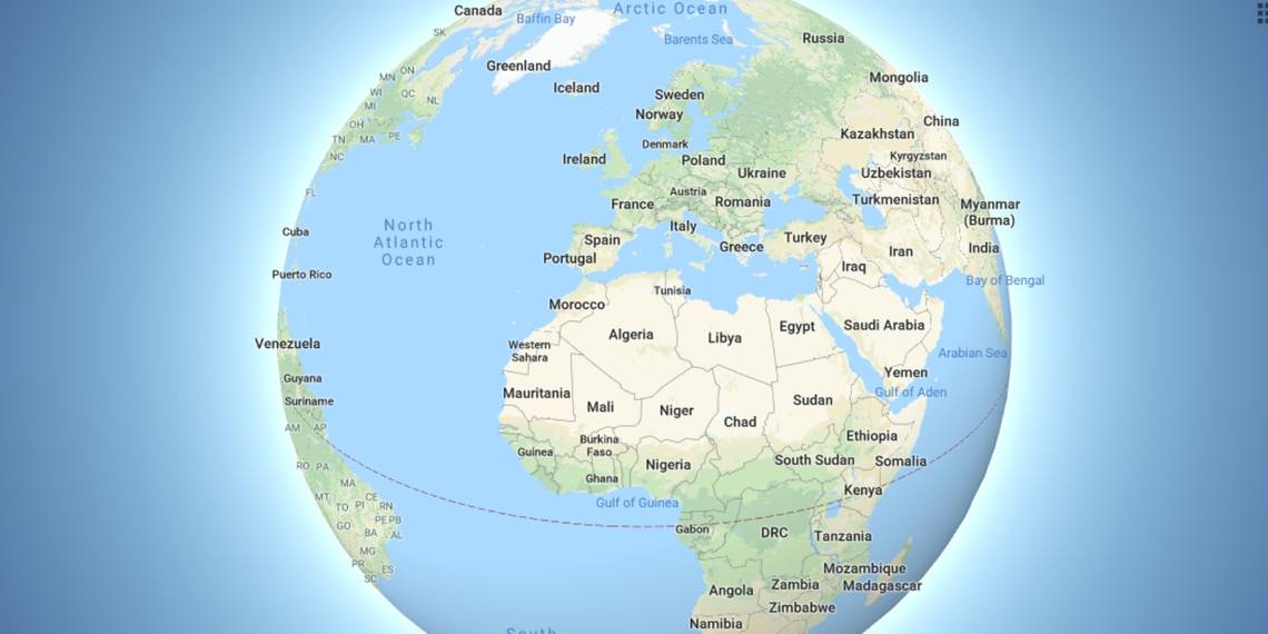
Google has updated Google Maps so that it no longer shows Earth as a flat plane. Instead, when you zoom out far enough, the view switches to a 3D globe. This shows the Earth as a sphere, with all of the countries and continents the correct dimensions.
Despite the overwhelming evidence to the contrary, there are people out there who think the Earth is flat rather than a sphere. The reasons differ from person to person, as does the levels of sincerity. But Flat-Earthers are amongst us, regardless.
Which is why some people aren't too happy with the latest Google Maps update.
Google Maps Is Technically Correct
Google Maps has, until now, used a Mercator projection of Earth. A Mercator projection displays Earth as a flat map, as if the globe has been pulled apart and flattened. Mercator projections are mostly used for nautical purposes.
The problem with Mercator projections is that countries and continents become distorted as you move away from the equator. Which as far as Google Maps is concerned, made Greenland (836,000 square miles) look the same size as Africa (11.73 million square miles).
Now, Google has updated Google Maps so that it shows Earth as a 3D globe. So when you zoom all the way out from your location you'll see the world as a 3D sphere. And all of the countries and continents will be the correct size and shape.
This small-but-significant update has been welcomed by everyone... with the exception of Flat-Earthers, for obvious reasons. While the old Google Maps didn't represent Earth exactly as most of them believe it to be, it was at least flat.
The Mobile Apps Are Still Flat-Earthers
The new 3D Globe Mode currently only works at Google.com/maps, with the apps still showing the Earth as flat. However, thanks to Google's use of WebGL, the new view should work across most web browsers, including the much-maligned Microsoft Edge.