Geotagging photos and visiting them by location is a topic which we have covered before. Mark showed us how to geotag your Flickr photos on Google Maps & Earth. He used a bookmarklet called Localize to geotag Flickr photos. That's going to a third party, and there are lots of other ways to geotag photos too.
But Flickr has its own geotagging utility that's a great help with your Flickr photos. That's where we will be going in this post in a while.
Geotagging is about adding location information to your photos that shows where it was taken from. It's commonly in the form of latitude and longitude coordinates, and also place names. It helps if you have an auto-geotagging capable camera coupled with a GPS. But thanks to geotagging web apps, the place data can be added later too.
The location gets added to a photo as metadata. Adding location based information to a photo enables us to search them out using a location search. We see examples of geotagged photos on interactive maps like those from Google and on Google Earth.
Flickr on the other hand uses Yahoo Maps. Flickr is owned by Yahoo, and you can jump in with your Yahoo ID. If you want to geotag Flickr photos and Yahoo Maps, it is as easy as a drag and drop. Here's how"¦
-
- Log into your Flickr account and click on the Organize & Create (Organizr) tab for your photostream.

-
- You can geotag a batch of photos or do them individually. Click on the Map tab to bring up the Yahoo Map interface. The Yahoo Map has navigational tools like the slider, the direction button, and the three different map views. You can use your mouse to scroll around the map. To zoom in and center you can double click on the location.

-
- Start your geotagging by typing in the location in the Find a Location search box. Type in the location where the photo was taken. You can also be more specific with the exact address of the place. You might get better address specific results with locations that are in the U.S and Europe than in the rest of the world.

-
- With your location setup, geotagging a photo or a bunch of photos is a simple process of selecting the thumbnails from the Finder and dragging them to the spot on the map. To remove the location data just drag the photos back to the thumbnail strip.

-
- Clicking on the photos brings up the Edit dialog where you can add more information. Here, you will see that the longitude and latitude coordinates have been added to the photos. The permissions as to who can view the location data can be set from this dialog.

-
- The access permission to the photo itself (and Creative Commons attribution) can be decided on the Permissions page of the dialog.

-
- Depending on the permissions setup, the geotagged information is viewable alongside your pictures in your photostream.

The obvious benefit of geotagging photos is immediately clear when you click on the linked place names. Clicking on Map gives you the location perspective on a map.

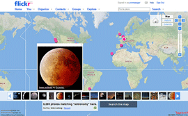
The nice feature is that you can view other photos that have been shot nearby by clicking on See nearby photos and videos. Your own geotagged photos also become searchable by location.
Your publicly viewable photos also become a part of Flickr groups corresponding to that location. If you are a budding photographer, similar photos give you free photography lessons on how to work different angles with your camera at a location.

The slight negative of using Yahoo Maps for geotagging is the level of detail. The map view isn't as specific as one gets on Google Maps. For instance, zooming into some locations around my country, India, did not give me street level details. But the richer part is that with geotagging I could become a part of Flickr groups made up of location tagged photos.
If you do not own a GPS capable camera, do you set out to geotag your Flickr photos?
Image Credit: premasagar