I have to admit that I'm a sucker for cool, high-tech displays that constantly update with interesting data in real-time. It's one reason that I wrote about real-time display widgets and tried to use those to create a whole page filled with cool looking do-hickeys with data and graphics scrolling across. My obsession with visual data also transformed into the article on visualizations.
Bottom line is that I really don't like having to build those applications myself - it takes a lot of time and effort. I'd much rather install an app that does all of the work - with very little setup. One of the things that I'm fascinated with is space, starting from the region starting in Earth's orbit and expanding outward. So I was pretty excited to stumble across an application that constantly monitors and tracks the current position of the majority of satellites that are actively orbiting the Earth at any given time.
The application is called Gpredict, and it is about as close as you can get to having a satellite-monitoring ground station right on your own computer screen for free. I usually don't even bother installing most of the satellite tracking apps out there because they're usually extremely simple and not very exciting. Many of the Android apps out there that are meant to track satellites are fun and interesting, but limited in what they can do.
That is not the case with Gpredict. It's very well written, very functional, and it looks really cool maximized up on my second screen while I get work done on my primary monitor. Watching and tracking the path of satellites is a fun way to occupy a screen that you may not be using at any given moment.
Using Gpredict To Track Satellites
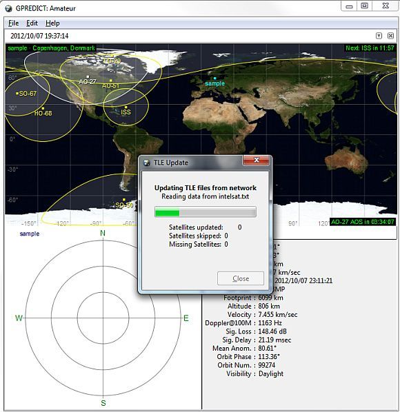
Gpredict is available to download for Linux, Mac or Windows. Once you install and run it, the first thing that you'll want to do is go into Edit and the Update TLE and select "From Network". This will update all of the latest telemetry data from online sources. The update takes a little while, but once it's done, you're ready to roll.
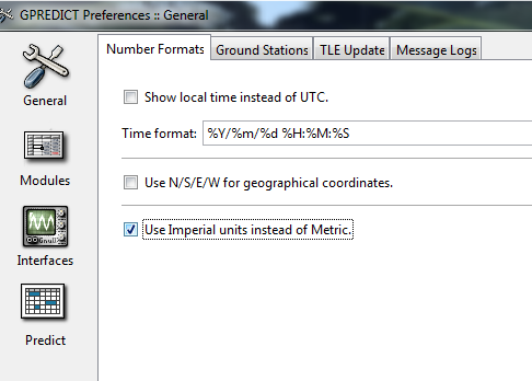
The next thing you'll want to do to configure the satellite tracking display to match the date format and the type of data that you prefer to see. You do this under "Edit" and "Preferences". On the "Number Formats" tab is where you can format the dates to display however you like, and also choose whether or not you want distances and speeds to display in metric.
Modules, Interfaces and Predict are interesting settings to check out, but for the most part people will just leave these as default. Interfaces is a really cool feature where experts can configure the software to communicate directly with hardware - radios and rotators to be exact.
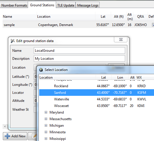
The Ground Stations tab is where you'll set up your nearest ground station. This is a good idea to configure because it provides you with an awesome "radar display" in the lower left corner of the window that shows you the overhead satellites where your ground station falls within the ground track. There are many ground stations all around the world, and the odds are pretty good that you'll be able to find one near you.
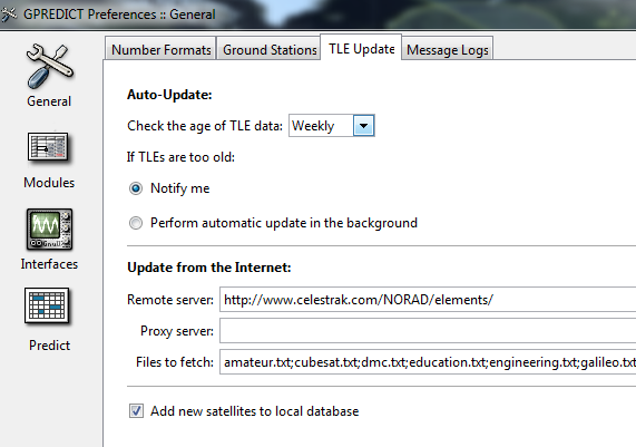
Unless you think you can remember to check for new telemetry data every so often, you might want to configure settings in the "TLE Update" tab to go out and update your TLEs on a regular basis automatically. The remote server and files are already set to a default location. If you know of another one that you prefer, feel free to fill in the details here.
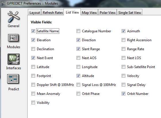
The "List View" tab is where you define the list of information that will be displayed for the satellites that you select in the main screen. You can define it to display as much or as little data as you want.
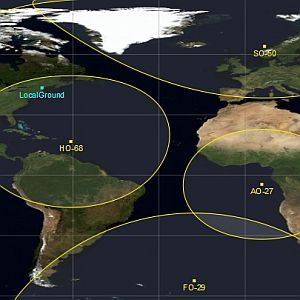
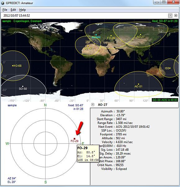
Once you're done configuring the software, it's time to start enjoying your very own desktop satellite tracking system. The entire display looks like the screen below. My favorite part is definitely the really cool "radar" display at the lower left - a fast way to spot the satellites that are flying by in orbit right above your location.
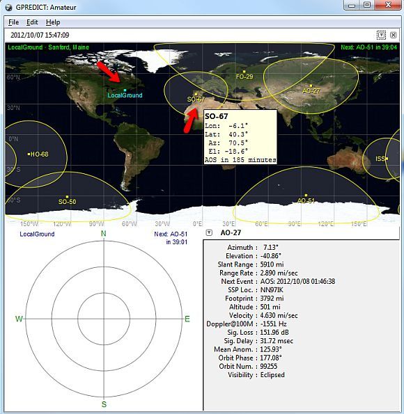
The "LocalGround" dot on the map is the ground station that you've defined in the settings. If you want to see details about any of the orbiting satellites, just hover your mouse over any of them and a small pop-up window will give you a summary of that satellite's location and how long before the next AOS, which is the next time the satellite will rise above your horizon. If it's already within your horizon, it'll show you how long before that satellite drops below the horizon.
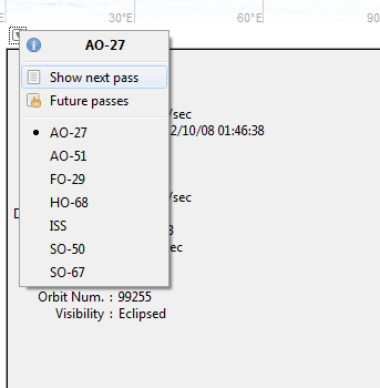
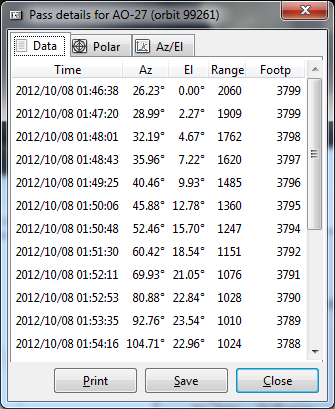
If you select any satellite on the world map, you can us the name dropdown list on the lower right corner of the screen to select "show next pass" or "future passes" to see details about the exact dates and times that the satellite will pass across your horizon.
This data is very detailed, and you can scroll down to see the date/time and position of the entire path, or you can see "future passes" which gives you a breakdown of the next 10 dates that the satellite will enter into your horizon.
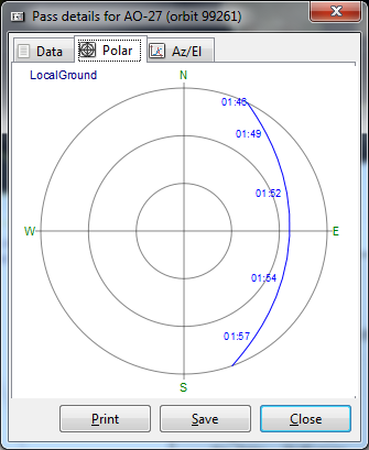
If you like to see graphics rather than number data, you can click the "Polar" tab to see the full path of the satellite graphed out by time.
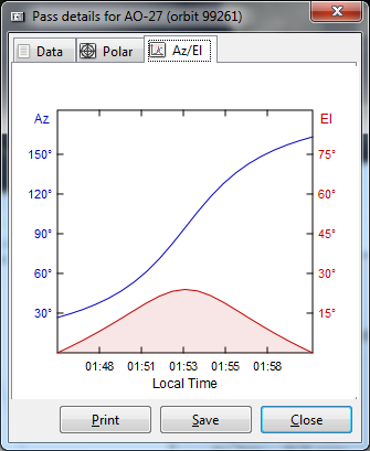
The Az/El graph also gives you a breakdown of the change in satellite azimuth and elevation at each time point in its path across your horizon.
As you can see, Gpredict doesn't only give you a really cool real-time display of satellites coasting along in Earth's orbit, but it also gives you a powerful prediction tool that shows you where and when all of those satellites are going to pass through the horizon of your ground station, or any other ground station across the world.
Do you love space-based applications like this as well? What's your take on Gpredict? Share your thoughts and feedback in the comments section below!

