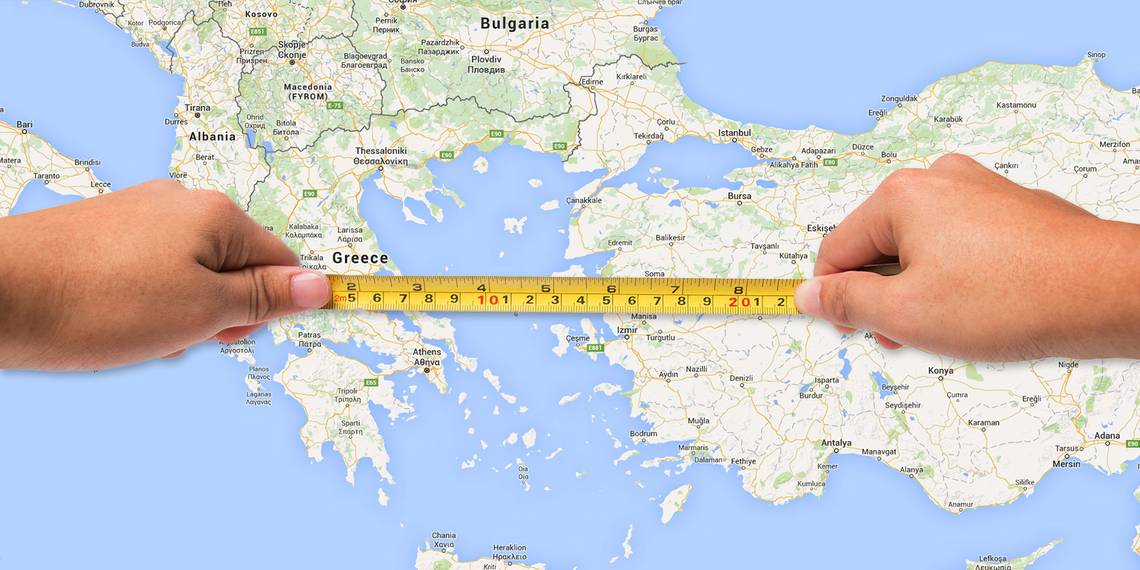
Have you ever found yourself wondering how to measure area on Google Maps? Some good news: both Google Maps and Google Earth include tools that will automatically measure both distance and area for you.
Accomplishing this isn't complicated or time-consuming. You just need to know the process. Here's how to calculate distance and measure area on Google Maps or Google Earth.
How to Measure Distance in Google Maps
You can easily measure distance in Google Maps using built-in tools. Choosing two points on the map will yield the shortest possible distance ("as the crow flies") between them. You can also add multiple points to track a specific path more accurately.
First, right-click on the starting point and select Measure distance on the menu that pops up.

Click on your second destination on the map. Once this point is selected, Maps will automatically show a popup with the distance between both points, next to the text Total distance.

If you want to add more points to your measurement, simply click additional points on the map.
If you want to trace a path instead of a straight line, you can add multiple points along a route to get an accurate measure of the distance you would need to travel. This is especially useful when it comes to measuring the distance of a hiking trail, for example. You can also adjust points already on the map by dragging them to a new location with your mouse.

As you trace the path, the distance will keep updating in the popup at the bottom of the map. Once you're done tracing the trail or road as best as you can, you'll have a precise measurement of the total distance.
When finished, clear out your traced points and measurements by right-clicking on the map and selecting Clear measurement from the menu. You can also press the X on the measurement window to clear your points.
A useful tip: If you want to just know the distance between two cities linked by roads, just Google "Distance from City 1 to City 2", including the names of the locations. Maps will automatically calculate a route for you and give you the distance based on the selected mode of transport.

Try this and other tricks to use Google Maps like a pro.
How to Calculate Area on Google Maps
Can you measure area on Google Maps? Yes, Maps has a built-in area calculator that automatically works out this figure for 2D objects.
If you want to calculate area in Google Maps, you will need to zoom into the property or location that you're interested in. Once close enough, Google will show the property boundaries if they are available. You can also switch between map and satellite view if this makes delineating property walls easier.
To calculate area on Google Maps, you'll start with the same process as you did for measuring distance.
Right-click on the map at your starting point and choose the Measure distance option.

Add points around the location's boundary. Once you close the shape by clicking on the starting point, the Google Maps area calculator will automatically process the area of your shape and display it in a popup next to Total area.

You'll see the total area in square footage and square meters, and the total distance in feet and meters at the bottom of the screen.
How Google Earth Differs From Maps

Google Maps is good enough, so why bother using Google Earth in your browser to measure distance or area? Google Earth is actually a bit more powerful than Google Maps when it comes to doing measurements.
Measuring area on Google Earth is similar to measuring area on Google Maps. But it also offers some interesting tools that let you:
- See altitude.
- Save all of your measurements.
- Measure 3D objects' height and area, such as the height or width of a building (Google Earth Pro).
Let's take a look at how you can do all of this with Google Earth.
How to Measure Distance in Google Earth
Google Earth is more detailed than Google Maps, but measuring distance with Google Earth works similarly.
You will first need to launch Google Earth in your browser. Go to the website and select the button that says Launch Earth. Then, click the Search icon (a magnifying glass) and enter the location you want to view. To start measuring, select the ruler icon at the bottom of the left-hand sidebar.
Once you click this icon, Google Earth will switch to a top-down view and ask you to select your starting point. A small popup will also appear on the top-right of the window, showing distance.

As you select more than one point, this popup will update with the total distance measured.

When you select Finished, you can start a new measurement by clicking on Start new. You can also change the measurement units, converting them to kilometers, yards, nautical miles, or any other unit available by clicking on the dropdown menu next to the measurement.
If you want to measure the distance for something like a mountain trail, you can switch to the Google Earth 3D view after selecting the ruler icon. This lets you measure large objects such as mountains or paths with inclines.
Simply select the 3D icon to switch your view, then select the Ruler icon to begin measuring as usual.
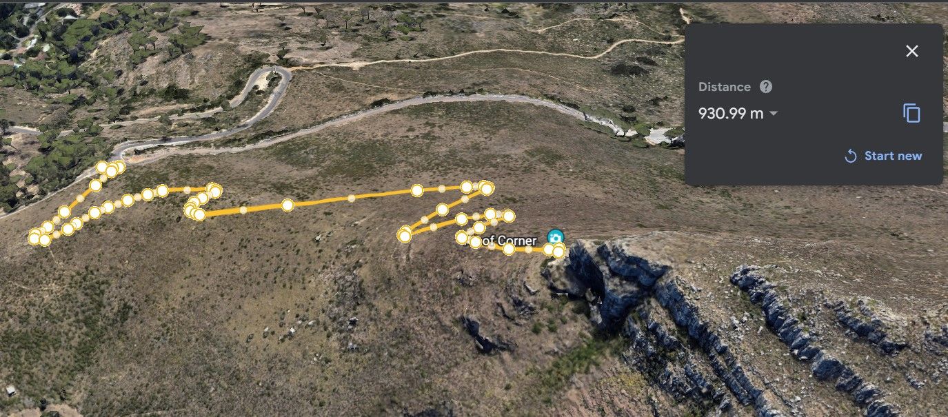
While this allows you to measure inclines, if you want to measure the height of buildings or objects, you will need to use Google Earth Pro.
How to Measure Area in Google Earth
Google Earth also lets you measure the area of large plots or locations. For a large enough area, you'll want to outline the perimeter of the location that you want to measure. You will start off in the same way as when measuring distance, with the Ruler icon.
Once you select multiple points and close the outline by selecting your starting point again, Google Earth will automatically calculate the area contained.

Again, you can drag points to change the outline or switch between units of measurement. You can also switch between 2D and 3D views.
How to Measure 3D Objects and Buildings With Google Earth Pro
To measure the area or height of a 3D object in Google Earth, you first need to download Google Earth Pro. The software is free, but more powerful with additional features compared to the browser version. Once installed, fire it up and find the building that you want to measure with the search bar. Google will then center itself on this location.
You can adjust your view by tilting the world while holding your center scroll wheel, or with any of the on-screen controls.
If you don't see the ruler icon, you can access it by going to Tools > Ruler.
A small window will pop up with various modes for measuring. Select the 3D path tab to measure a 3D building, like the Arc de Triomphe. The mode is used for measuring the height and width of buildings in 3D view.

Next, click at the base of the building and the top of the building to create a vertical line measuring its height. The ruler window will then automatically calculate the height.

When you want to start a new measurement, click Clear.
How to Measure the Area of 3D Objects
To measure the area of a 3D object, you need to switch to the 3D polygon tab. If you continue using the 3D path tool, it will just continue to measure the length of the line.
Once you switch to the 3D polygon mode, plot out the points for the area or perimeter you want to measure. When you add three points, Google automatically creates a triangle. However, continue adding points to trace the outline of your object.
Once you have added all the relevant points, Google Earth Pro will have a calculation of the perimeter and area of your shape.

Add as many points as needed to trace the outline of the object you are measuring. You can drag these points to adjust the size of your shape for a more accurate reading. The area calculation automatically updates as you change the positions of points.
Do More With Google Maps
Google has updated its suite of tools significantly over the years to add even more functionality and convenience. But Google Earth and Google Maps continue to surprise us with their useful functions.
Now you know what's needed for measuring distance and areas in both programs, including the area and height of 3D buildings.