Gone are the days when you would purchase maps after landing at your destination. These days we plan our trips and rides before hand using Google Maps. It displays everything from hotels to places to routes to transport. Just one thing, you won't be able to get Google Maps to work on the go, unless you have Internet access.
It would be totally awesome if you could somehow take the map along. Google offers a print option but you can only print what you are able to fit on the screen which is hardly the solution you are looking for if you want to get a map of the entire city at the desired zoom level.
You can save the map as image files and go through the pain of stitching them together in Paint or Photoshop. Or you can spare yourself some trouble and get Google Maps to work offline with Google Map Buddy, which does everything for you in a click.
It doesn't require any installation, just extract the zip file, run the executable and you are good to go.
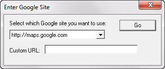
Using the Google Map Buddy interface you can browse to the Google Maps site you want. Search for or navigate to the location you wish to create the map for. You can zoom in or out so that you can see the entire region for which you want to create the map. Let's say you want to create a map for the city of Paris with all the major roads, landmarks and public transit stations.
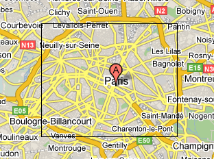
Such details are visible when you are zoomed in pretty close, in which case you cannot fit all of Paris on your screen. So Google Map Buddy allows you to zoom out to a level where you can see the entire Paris on your screen (don't worry if you can't see the details at this zoom level) and specify the area you want to create the map for.
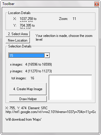
Now click the draw button, and draw a rectangle encompassing the entire Paris at your current zoom level. You don't need to zoom to the desired level of detail because Google Map Buddy lets you specify the zoom level of the map that it will create. So you can zoom out to fit the required region on the screen, and then specify a higher zoom level inside the application's toolbar to get a more detailed final map.
Once you have specified the details, hit create map and the application gets to work. It downloads the required tiles and stores them all on your hard disk. Once it has downloaded all the images it then stitches them together to create a complete detailed map according to your needs.
It can take quite some time to download and stitch all the images, so you would have to be patient while it is working. It would be nice if the application displayed a progress bar or current activity information to let the user know what it is up to.
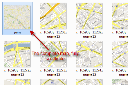
After all the downloading and stitching together has finished, your map is viewable as a image file. You can scroll and zoom inside the map image just like any other image file that doesn't fit completely on your screen. Put it on a USB drive, your iPod, your mobile phone (or maybe print it) to take it along. The tiles that it used to stitch together the map are also available just in case you need them, you can keep them or delete as you wish.
Do you know of any similar application you use with Google Maps? Let us know about it in the comments.


