With GPS in every iPhone sold, you might wonder why you need to buy a dedicated GPS for driving or hiking any more. The good news is that your smartphone really can take on the role of a dedicated GPS, but there are a few things you'll need to keep in mind when doing so.
Today we'll be looking at the best apps, practices, and precautions to keep in mind if you want to take your iPhone out with you into the wilderness. Don't forget to protect your precious smartphone with a rugged case if you do intend for it to become your walking companion.
Using an Android smartphone? Check out this list of apps instead.
Smartphone or Dedicated GPS?
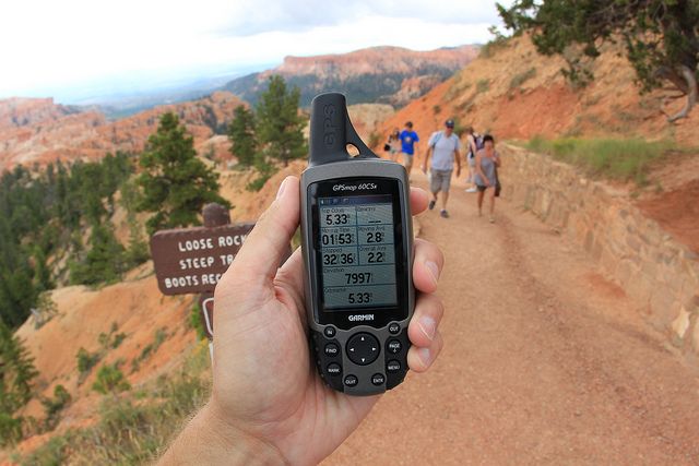
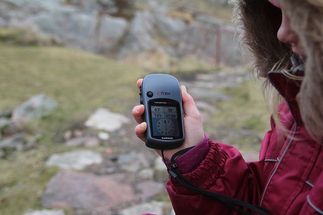
If you're deciding between a dedicated GPS unit [Broken URL Removed] and simply using your smartphone, it's important to remember that there are a few key differences between the two. Generally, a dedicated GPS unit is going to be a better choice purely because it has been designed with the outdoors in mind.
However, your iPhone's limitations aren't entirely insurmountable with a bit of forward planning, a few accessories, and the right apps.
Battery Life
Let's face it — smartphone battery life is still disappointing. While the modern GPS chips found in the latest devices are considerably more power efficient than those found in earlier smartphones, sustained use of GPS, your iPhone's screen, and the cellular network will quickly drain your battery.
Many dedicated GPS devices favor replaceable batteries, often in the form of AA cells, which are easy to find and carry. By comparison, your smartphone uses a fixed rechargeable lithium-ion cell, so it might be worth investing in some sort of emergency charger that allows you to use standard AA batteries, which you could stock up on.
Don't forget that there are also solar-charging options, as mentioned previously when we showed you how to charge your phone while riding your bike. Voltaic Systems has backpack-mountable folding solar panels that allow you to regain some juice while you hike in the day, but you'll need around 3 hours of sustained exposure to charge your phone.
Whichever option you use, you should engage Airplane Mode (by swiping up from the bottom of the screen to reveal Control Center) to save battery while depending on your phone for GPS navigation, especially if you're out of range of cell towers anyway.
Durability
Most dedicated GPS units are built to be sealed against the elements, with rugged designs that can survive a knock or two. Your iPhone isn't waterproof, and breaking the screen will require some expensive repairs.
The best thing you can do is get yourself a rugged case like the Griffin Survivor, or something from Lifeproof or Otterbox. A few months ago I reviewed the Hitcase Pro, and it did a good job of protecting my iPhone even in wet conditions, but usability suffered as a result of the waterproof screen cover.
Which brings us on to another point: if you're hiking in adverse conditions, make sure you get some gloves that are designed to work with capacitive touchscreens. I have a pair of POC windproof cycling gloves for this, but there are hiking solutions like The North Face ETIP gloves ($45) too. Many dedicated GPS units avoid touch controls in favor of joysticks and buttons for this very reason.
Mapping
If you're not carrying a paper map, mapping is probably the most important part of choosing a navigation solution. The good news is that maps are generally a lot easier to acquire on smartphones than on dedicated GPS units, thanks to apps built with ease of use in mind.
While dedicated units (particularly older ones) often require a trip to a local hiking shop to have maps pre-loaded, smartphone mapping apps can save maps to your device in a few taps. Dedicated units rely on detailed maps, often with a price point to match, while there are lots of good free mapping solutions available on the App Store (with admittedly inferior levels of detail).
But that's the nature of an app ecosystem — there are solutions to suit all users and budgets. And while many dedicated GPS units use inferior screens, an abundance of satellite photos of the area may even enable you to navigate without a GPS fix, provided you have the area saved to your iPhone and aren't relying on a patchy cellular connection.
GPS Performance
Speed and accuracy can vary between devices, but it's generally accepted that dedicated units have higher levels of accuracy, since they're built for a purpose and can take advantage of more satellites than smartphones can.
Regardless of this performance, though, both smartphones and GPS units will have difficulty getting a location fix in certain situations — like in a forest under thick canopy, or in deep valleys or enclosed spaces.
The GPS units found on smartphones are built with cell towers in mind (which is why devices like the Wi-Fi only iPad or iPod Touch don't come with GPS), which enables them to get a fix far quicker than many dedicated devices. If cell towers aren't in range, then performance suffers, but dedicated devices can't take advantage of this kind of assisted GPS, so they will usually take longer.
Supercharge Your iPhone GPS
If you want to expand your iPhone's access to a greater number of satellites, you can do so with an external GPS receiver like the Bad Elf GPS ($130, or Bluetooth version for $200) or Dual SkyPro ($150), both of which add fast signal acquisition, access to GLONASS (Russia's version of GPS), and take the strain off your iPhone's built in GPS receiver.
They work with your existing apps, but just like your smartphone, they'll need charging as they are dedicated devices — so make sure you're prepared for this too.
Free Navigation Apps
Depending on how serious you are about hiking, you might find one of these free solutions to be more than adequate. They offer a good starting point for day hikes, trail hiking, and those of you who aren't venturing into the great unknown.
Maps.me
I discovered Maps.me last year while looking for a truly free offline mapping solution I could use here in Australia. The app comes with proper offline mapping, allowing you to download whole countries and continents in a couple of taps, and even supports offline navigation if you happen to venture back into populated areas.
The app is mostly designed with urban navigation in mind, but I used it over the summer to follow trails and check progress on several day hikes in areas with no cellular reception. There's a decent level of detail that will suffice if you already know where you're supposed to be going, though this may vary depending on where you live.
Alternative: Galileo Offline Maps offers a similar feature set, with a few paid options.
Google Maps
Probably the best navigation app for the iPhone, Google Maps provides a good level of detail, satellite photos, and displays many trails and cycle routes for budding outdoor adventurers. Unfortunately, the app is let down by lackluster offline mapping, which limits offline access to a fairly small area — though this shouldn't be a problem if you're only using it for day hikes.
There's also no way to plan a route on your phone, and there are limited options for transferring custom routes from a computer to your mobile device. Whether you're hiking with it or not, it's worth having Google Maps installed on your iPhone for everyday use.
Alternative: HERE Maps now has offline mapping for over 100 countries, but that last time we checked, the maps weren't as good as those offered by Google.
AllTrails
Technically a free app, AllTrails does make use of a $30 in-app subscription to provide users with access to offline mapping. While that might seem steep, it's a small price to pay considering how easy AllTrails makes it to get out and get exploring.
Rather than focusing on the maps, AllTrails offers a list of trails that are sorted by location, length, difficulty, and user rating. It's essentially a curated app for trail hikers, and if you'd rather pick a preset trail than create your own, this is the app for you.
The focus here is on North America, with over 50,000 trails listed for that region alone, but the free price tag means you can download it and see how it fares in your part of the world before spending a penny.
Alternative: A trail walking app local to your region — whether it's Britain's Peak District, Victoria's national parks in Australia, or Yellowstone in the United States. All of these are free, so have a look and see what you can find.
Premium Navigation Apps
You'll often have to buy maps even if you purchase a dedicated GPS unit, so if you can make your smartphone work as an outdoor navigation device, you'll have more money to spend on software, batteries and weather-proofing. Here are just a few of the many paid GPS apps out there.
Gaia GPS [No Longer Available]
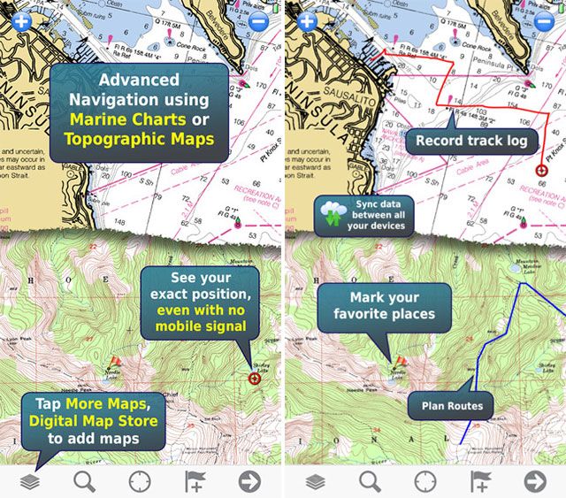
Wherever you are in the world, Gaia GPS offers topographic, road and aerial maps with unlimited offline downloads to your device so you can use it offline.
Before you cough up the $20, you can head to gaiagps.com/map and browse Gaia's unique topographic vector map to find out if it does what you want it to. The app includes an Apple Watch app, so you can check where you are with a glance at your wrist.
Users in North America can make use of USGS, USFS, and NRCan data in-app, and there's even weather radar data and points of interest included if you need them. You can sync routes and tracks with Gaia's website and other devices running the app, track your adventure, and import GPX or KML files. Subscribing for $20 per year will get you access to map layering, MapBox maps, and printing options.
Alternative: Offline Topo Maps [No Longer Available] is a simpler version of Gaia, from the same developers. It retains offline downloads, topography, USGS maps, and an Apple Watch app at the expense of other features.
Memory Map (Free, in-app purchases required)
While the Memory Map app is technically free, you're not going to get very far without shelling out for some mapping data in the form of in-app purchases.
Memory Map originally started as navigation software for PCs and dedicated GPS units, offering modular purchases of specific regions in varying levels of detail. The iPhone app is no different, with a vast catalog of charts and maps available.
You can plan routes from your smartphone, use the companion Windows app to transfer routes (unfortunately, there's no Mac version), or import GPX files or use your device to track where you've been. The best thing about the Memory Map catalog is that it spans the entire globe, and it's an excellent choice whether you're in North America, Europe, Australia, South Africa or beyond — check out the full catalog online.
Topo Maps ($7.99)
This is a simple, cheap, and rather no-frills app that's great for North American users, providing access to 70,000 USGS and Canadian topographic maps (including Alaska) that you can save to your device for no extra charge.
There's support for waypoints (and planning a route in-app) as well as GPX, KML, and CSV file import. One thing to keep in mind is that the developer has opted for slightly older USGS maps over newer ones because "they do not show hiking trails and lack other details."
Topo Maps might not be suitable for users in other parts of the world, but for a cheap and powerful North American mapping solution it's a great choice.
OS Maps (Free app, requires subscription)
OS Maps is a new app that's technically free, but requires an ongoing subscription if you really want to make serious use of it. It's an official app from Ordnance Survey (no longer available) and offers digital downloads of the maps hikers have been using for generations.
Plan routes right there in the app, or use suggested routes to find out where to go next. The app also features support for adding digital versions of new paper OS maps you buy from hiking stores — just enter the code and download away.
MotionX GPS [Broken URL Removed] ($2.99)
If you're after a cheap app that provides access to maps for a variety of activities, MotionX GPS could be a good choice. You'll get access to MotionX's own road and terrain maps (which you can browse here [Broken URL Removed]), as well as NOAA charts, a companion Apple Watch app, all the free downloads your device can handle, and support for 300 tracks and 2,500 waypoints.
Other Apps
While modern GPS devices are getting more sophisticated, they still can't hold a candle to the flexibility offered by your smartphone. Here are a few other apps you might be interested in while hiking that aren't strictly focused on navigation.
Yonder (Free)
Yonder is a social and discovery app focused on the outdoors. It's a bit like Instagram meets AllTrails, and it uses your location to find points of interest around you thanks to an impressive database of geo-tagged images. The app isn't just focused on hiking, and it's suitable for a range of outdoor pursuits.
Geocaching (Free)
All around the world people have been hiding "geocaches" for others to find, and the Geocaching app allows you to play along using only your iPhone. You can get access to "easy" drops for free, or opt to subscribe ($10 every three months) to get access to the entire database.
SAS Survival Guide ($5.99)
The UK's Special Air Service is known around the globe for its military prowess, and the SAS Survival Guide has been available in print for around twenty years. Now you can download a digital edition that includes all 400 pages of the book, plus additional videos and photos to help you survive in a range of adverse conditions.
Alternative: US Army Survival Guide ($1.99) is a cheaper app that provides similar information.
Compass
This one's built into your iPhone! Whether you've packed a few paper maps as a backup or you simply know you need to head north, when all else fails, your iPhone functions as a digital compass too.
Yahoo Weather (Free)
Feel free to replace this one with a weather app you know and trust. I like Yahoo Weather because it provides 10 day forecasts, access to radar information, chances of rain, and a Today screen widget. Don't forget that you'll need access to the Internet to update a weather app, which isn't much use if you're out of cell tower range.
Alternative: Check out our list of unorthodox weather apps.
Do You Use Your iPhone for Hiking?
Dedicated GPS units are expensive, and then you have to buy maps too. By contrast, smartphones offer a much cheaper solution to navigation, but you'll need to make allowances for power and weatherproofing.
You might find smartphone apps easier to use, but you generally can't beat a dedicated unit for accuracy. The smartest solution might be a combination of the two, but we'd like to know what you think.
Do you hike with your iPhone? Let us know where you've been, and how it went in the comments below.
Image credits: tourist traveler by Maria Savenko via Shutterstock, Geocaching (Rolf Steinar Bergli), GPS tells the story (daveynin)


