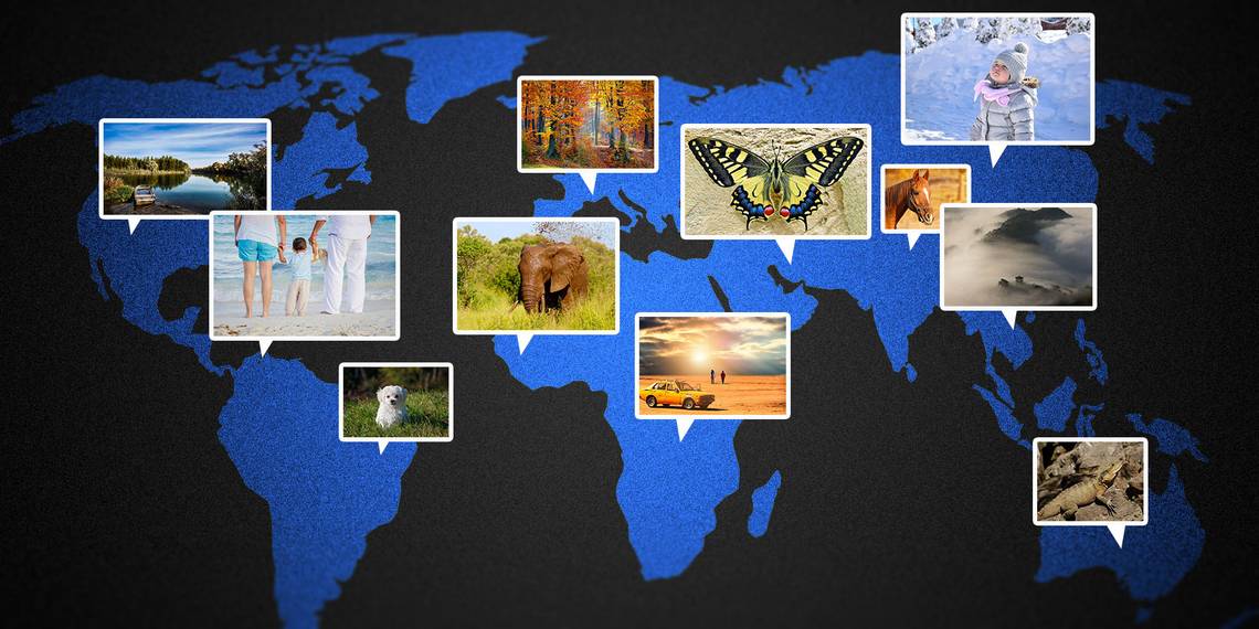
When you look back through your photo library, it's great to look at the places you've been and the things that you've seen. There's probably a time that you've looked back at your photos and wished that you could remember exactly where you were when you took that photo.
Or maybe you have a series of photos that you got in some hard to find places that you want to share with the world at large.
Whether you want to figure out where you were when you took that photo, look through your photo library on a map or show off your favorite pictures and locations to others, geotagging your photos is the way to go.
What Is Geotagging?
Geotagging is a way of storing location data with your photos, allowing you to place your photos on an exact location on a map. It stores the position's latitude and longitude as two numbers in the image file's EXIF data, which stands for Exchangeable Image File Format.
In short, EXIF data is metadata that stores contextual information about the image rather than actual image data. For example, it might include details on the make and model of the camera used to snap the image, or it could describe the resolution of the shot and the timestamp of when it was taken, or the camera settings at the time of capture (i.e. ISO, aperture, shutter speed).

There are also fields in the EXIF data dedicated to storing the location of where the image was taken. This data can then be accessed by your photo library application -- e.g. Adobe Lightroom, Apple's Photos app, or websites like Flickr and 500px -- to pin your photos onto a map.
Why You Should Geotag Your Photos
Geotagging is one extra way of organizing your photos in addition to albums or events. It can be an intuitive way of quickly finding the photos that you're looking for by simply finding the place on the map where you took the photo.
Conversely, if you have the photo but don't know where you took it, a geotag will allow you to see exactly where it is on the map.

Also, if you post your photos online to social media or a photo website, geotagging your photos makes it easier for other people to find your photos. For example, placing a geotag on your super impressive photo of the Grand Canyon on Flickr will make it more likely to show up for people searching for pictures of the Grand Canyon, even if the words "Grand Canyon" aren't in the photo's title.
Methods of Geotagging
There are a few different ways that you can add geotags to your photos. Some rely on adding the data as you take the photo, while others add the data afterwards.
Automatic Geotagging
You may find that a lot of your photos are already geotagged without you having to do anything. Photos taken on a smartphone with GPS capabilities are usually geotagged automatically unless you've specifically turned off the setting. With every photo you take, your phone will record its current GPS coordinates and include them in the image EXIF data.
It's not just smartphones, either. Many newer point-and-shoot and DSLR cameras have GPS capabilities either built into the camera itself or have peripheral accessories that enable it.

Manual Geotagging
Even if your camera doesn't have GPS capabilities, it's still possible to place your photos on a map. Most applications and websites (like Flickr) allow you to add your location manually by clicking on a map or typing in a location. You can do this for each individual photo (which would be super time consuming) or you can apply it to entire groups of photos.
This way, even if you don't have the precise location for the photo, you'll still be able to find it on the map and help others find it.
Hybrid Geotagging
There's an even better way to get geotag data for your photos on a camera without GPS capabilities: using an app on your phone (like GeoTag Photos Pro) or a standalone device (like a Garmin eTrex) to record your GPS coordinates at set intervals. These coordinates are stored in a file -- usually a GPX file, which uses the GPS Exchange Format -- that can be imported into your photo library application.

The application can then compare the timestamps from your photos and the timestamps for the GPS coordinates in the file and apply the relevant GPS coordinates to your images. While the location data won't be quite as accurate as recording the GPS coordinates as you take the photo, it'll get you pretty close.
The smaller the interval between GPS recordings, the more accurate your location will be. The tradeoff is the extra power drain on your phone or device to keep the recording process on in the background.
Removing Geotags From Photos
You may have photos that you want geotagged in your own personal library that you want to share on the Internet without keeping their location data – pictures of your home or family, for example. In this case, you want to make sure that the photo's EXIF data (or at least the location part of it) is removed.
Some websites will preserve the EXIF data for each image, while some automatically remove it as each image is uploaded. For example, Google+ and Tumblr leave location data intact, whereas Twitter and Facebook (thankfully) remove it. Others, like Flickr, will give you the option to keep or remove it during the upload process.
If you want to make sure that location data is not included in the first place, most applications have some sort of setting to remove location data as you export your photos for sharing. There are also applications available for most platforms to remove location information from batches of photos all at once.
Get Your Snaps on the Map
Geotagging adds location data to your photos so that you can see where they were taken and display them on a map. Smartphones have this capability built in, and you can use your smartphone or another GPS receiver to retroactively add geotags to your photos from a camera without GPS capabilities.
Do you geotag your photos? What method do you use? Let us know by leaving a comment below!
Image Credits: YellowShark via Wikimedia, Patche99z via Wikimedia